Basic Map Reading and Trail Safety
- -->> 4. Basic Map Reading and Trail Safety
What you'll learn
 Map Reading FundamentalsCompass Navigation TechniquesEssential Trail SafetyEmergency Preparedness
Venturing into the great outdoors offers unparalleled opportunities for adventure, tranquility, and connection with nature. However, these experiences come with inherent risks. To truly enjoy and safely navigate wilderness environments, fundamental skills in map reading and trail safety are not just beneficial; they are absolutely essential. Mastering these basics can mean the difference between an enjoyable excursion and a perilous situation, ensuring you can confidently explore while minimizing potential dangers.
The Essential Tools for Navigation
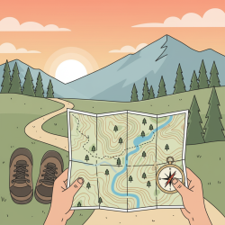
Before stepping onto any trail, equip yourself with the right tools. While modern technology like GPS devices and smartphone apps are incredibly useful, they can fail due to battery depletion, signal loss, or damage. Therefore, a traditional topographic map and a reliable compass remain indispensable.
- Topographic Map: These maps provide detailed representations of the Earth's surface, showing not only trails, roads, and water bodies but also crucial elevation changes through contour lines. Understanding what these symbols and lines signify is the first step in effective navigation.
- Baseplate Compass: A simple yet powerful tool, a baseplate compass works by aligning its magnetized needle with the Earth's magnetic field, pointing towards magnetic north. It allows you to orient your map, determine your direction of travel, and take bearings to landmarks.
Always carry both, along with a waterproof case for your map, and know how to use them together before your trip begins.
Understanding Your Map
A topographic map is a treasure trove of information, provided you know how to decipher it. Key elements to focus on include:
Scale: Located on the map's legend, the scale indicates the ratio between a distance on the map and the corresponding distance on the ground. For example, a 1:24,000 scale means one inch on the map equals 24,000 inches (or 2,000 feet) in reality. This is critical for estimating travel times and distances.
Legend: The legend is your map's dictionary, explaining all the symbols and colors used. It will show you how trails, roads, rivers, peaks, campgrounds, and other features are represented. Always consult the legend for clarity.
Contour Lines: These are perhaps the most vital feature for understanding terrain. Contour lines connect points of equal elevation. When lines are close together, it indicates a steep slope. When they are far apart, the terrain is flatter. Observing their patterns helps you visualize hills, valleys, ridges, and saddles. Index contours are usually thicker and labeled with their elevation, making them easier to track.
Orientation: To make sense of your surroundings, you must orient your map so that the features on the map align with the actual features in the landscape. This typically involves using your compass to align the map's north with true or magnetic north.
Basic Compass Use
A compass is most effective when used in conjunction with a map. Here’s how to get started:
Orienting the Map: Lay your map flat. Place your compass on the map with the direction-of-travel arrow pointing towards the top (north) of the map. Rotate the map and compass together until the magnetic needle (the red end) aligns with the orienting arrow within the compass housing. If your map has magnetic north lines, align the needle with those. This step ensures that what you see on the map corresponds directly to the landscape around you.
Taking a Bearing: To determine the direction to a specific landmark: point the compass's direction-of-travel arrow at the landmark. Rotate the compass housing until the magnetic needle aligns with the orienting arrow. The number on the bezel at the direction-of-travel arrow indicates the bearing in degrees. You can then transfer this bearing to your map to confirm your location or plot a course.
Magnetic Declination: It’s crucial to understand magnetic declination. This is the angular difference between true north (geographic north pole) and magnetic north (where your compass points). Declination varies by location and over time. Your topographic map will usually provide the declination for that specific area. Many modern baseplate compasses allow you to adjust for declination, or you can perform a mental calculation when taking bearings.
Crucial Trail Safety Practices
Beyond navigation, good trail safety practices are paramount for preventing incidents and ensuring a positive outdoor experience.
Plan Your Trip Thoroughly: Research your route, understand its difficulty, and check weather forecasts. Inform a reliable person of your itinerary, including your route, expected return time, and who to contact if you don't check in. Pack enough food, water, and appropriate layers for varying conditions.
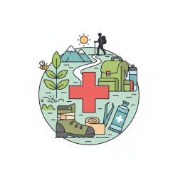
The Ten Essentials: While the specific items may vary, the concept of the Ten Essentials (or a variation thereof) is vital. These are categories of gear recommended for any backcountry trip, regardless of length, to help you survive an unexpected night out or deal with minor injuries. They include navigation tools, sun protection, insulation, illumination, first-aid supplies, a fire starter, a repair kit and tools, extra nutrition, extra hydration, and emergency shelter.
Stay on Marked Trails: This protects delicate ecosystems and significantly reduces your risk of getting lost. Deviating from the trail can lead you into dangerous terrain, unfamiliar territory, and make it harder for rescuers to find you if needed.
Be Aware of Your Surroundings: Constantly scan your environment. Look for distinct landmarks, trail markers, and changes in terrain that correspond to your map. Periodically check your location on the map to stay oriented. Pay attention to stream crossings, prominent rock formations, or unique trees.
Pace Yourself and Hydrate: Overexertion and dehydration are common causes of distress. Maintain a steady, comfortable pace. Drink water frequently, even if you don't feel thirsty, especially in warm weather or at higher altitudes. Electrolytes can also be beneficial on longer hikes.
Emergency Preparedness
Despite careful planning, emergencies can still arise. Knowing how to react is critical.
- If You Get Lost: Implement the S.T.O.P. acronym: Stop, Think, Observe, Plan. Stop moving immediately. Think rationally about your last known location and how you might have strayed. Observe your surroundings for any familiar landmarks or signs of human activity. Plan your next steps, whether it's to retrace your steps carefully or prepare for an unplanned overnight stay.
- Signaling for Help: Carry a whistle and a signal mirror. Three short blasts on a whistle is a universal distress signal. A signal mirror can attract attention over long distances, even on cloudy days. Brightly colored clothing or an emergency blanket can also aid visibility.
- Basic First Aid: A well-stocked first-aid kit and basic knowledge of how to treat common injuries (blisters, cuts, sprains) are indispensable. Knowing how to manage more serious situations until professional help arrives can be life-saving.
Summary
Navigating the outdoors safely and confidently hinges on mastering basic map reading and adhering to fundamental trail safety practices. Equipping yourself with a topographic map and compass, understanding how to interpret map features like scale and contour lines, and knowing how to use your compass to orient yourself are foundational skills. Complementing these with thorough trip planning, carrying the Ten Essentials, staying on marked trails, and being prepared for emergencies ensures a responsible and deeply rewarding outdoor experience. These skills empower adventurers to explore more freely, secure in the knowledge that they can handle the challenges the wilderness may present.
Comprehension questions
 What are the two most indispensable traditional tools for outdoor navigation, and why are they preferred over modern electronic devices as primary tools?Explain the significance of contour lines on a topographic map and what their spacing indicates about the terrain.What is magnetic declination, and why is it important to consider when using a compass and map together?List at least three crucial trail safety practices mentioned in the article, besides carrying navigation tools, and briefly explain their importance.
Community Poll
Next Lesson

Course Contents : A Beginner's Guide to Hiking
- >> 4.
 Basic Map Reading and Trail Safety